Terry Eliasen
terrywbz.bsky.social
Terry Eliasen
@terrywbz.bsky.social
WBZ-TV Meteorologist and Executive Weather Producer since 2002.
Opening day at Fenway looking terrific! The Weekend games, not so much
March 31, 2025 at 7:58 PM
Period of downpours overnight tonight...some areas will get may top an inch of water...long gone by Tuesday morning commute
March 31, 2025 at 7:58 PM
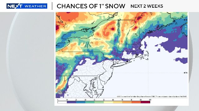
We MAY have seen the last of the snow in the Boston area for the season...chances over the next 2 weeks are extremely low.
Of course, you can never rule out crazy things happening in April, see 1997...
March 13, 2025 at 4:58 PM
Vernal equinox is a week from today...and I wouldn't be surprised if we hit 70 degrees around that time next week! Above average temperatures likely for at least the next 1-2 weeks in the Northeast
March 13, 2025 at 4:58 PM
Total Lunar Eclipse happens late tonight...unfortunately most in southern New England will be stuck in the clouds
March 13, 2025 at 4:57 PM
There is no snow coming our way
There is no wind to ruin our day
There is no more ice causing you to slip
Even the cold is about to loosen its grip!
February 21, 2025 at 5:18 PM
Highly impactful winter storm coming this weekend
February 13, 2025 at 10:04 PM
Couple cool sights in the sky tonight!
January 15, 2025 at 3:36 PM
Great pic taken last night by Jim Holland just before the Moon passed in front of Mars...You can see the Moon and Mars nearby over the next couple of nights
January 14, 2025 at 7:40 PM
A little light snow Saturday in southern New England, mainly just some fresh coatings...could be some spots with an inch or up to two
January 10, 2025 at 3:31 PM
Seems like a good time to look ahead to the first month of 2025. January is typically our coldest month and Boston averages more than a foot of snowfall. The forecast over the next 1-2 weeks is for lots of cold in the East
December 31, 2024 at 3:59 PM
Some final tweaks before the 5pm news on WBZ...small area just west and southwest of Boston where the "jackpot" amounts will be located. The typical "snowbelt" towns in Worcester county and northern Middlesex county are essentially being shutout this time
December 20, 2024 at 9:11 PM
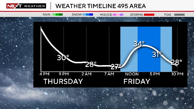
Timeline graphics help to give an idea of the timing and precip types tomorrow...rain/snow mix closer to the Coast and mainly snow northwest of I95.
Steadiest and heaviest in the afternoon and evening but some spotty rain/snow in the AM as well
December 19, 2024 at 9:09 PM
There will be some light rain and snow in the air Friday. Tough call on snow accumulation but most should get between a coating and 1". Could be a few isolated areas with an additional inch or two.
December 19, 2024 at 9:05 PM
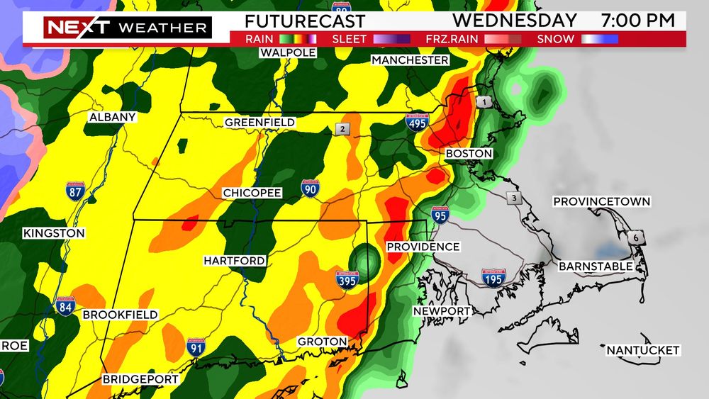
Our next storm system arrives Wednesday night...similar to last night but, rainfall amounts a touch higher and also a bit of snow in the higher elevations
December 17, 2024 at 9:41 PM
Some fun things happening in the night sky this weekend!
December 13, 2024 at 4:13 PM
Heaviest rain and strongest winds will be located over eastern and southeastern MA in the next 3-6 hours. These areas will be most susceptible to flooding, wind damage and power outages
December 11, 2024 at 10:22 PM
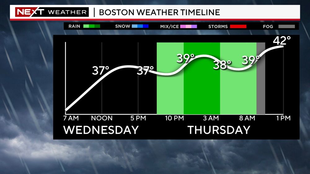
Few things to consider this evening or early tomorrow ahead of a very wet and windy day
December 10, 2024 at 9:00 PM
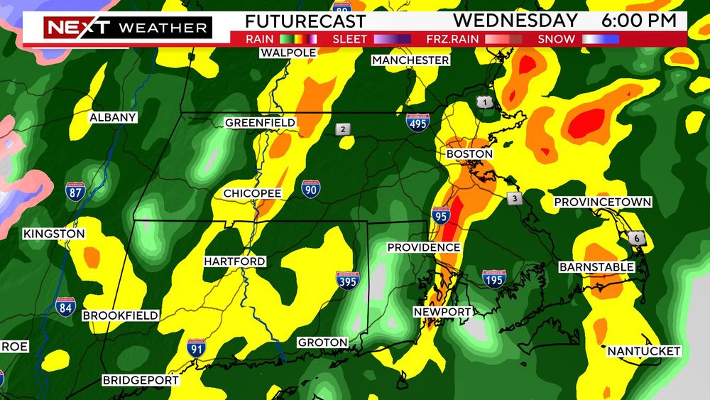
RAIN tomorrow will be heavy at times causing some inland flooding. Torrential downpours expected between 6p-Midnight. Rainfall totals could exceed 3" in some areas
December 10, 2024 at 8:58 PM
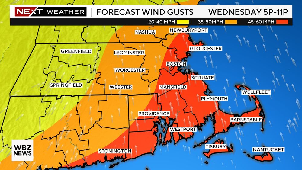
WINDS tomorrow will be strongest in the evening, between 4p-Midnight. Southerly gusts to 60mph possible across eastern MA
December 10, 2024 at 8:58 PM
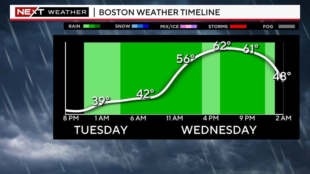
A very windy, wet and warm day Wednesday...some areas could see 1-3" of rain...SE MA may see gusts over 50mph and high temperatures will hit 60+!
December 9, 2024 at 5:05 PM
Round 1 of rain comes later today, between 3p-11p. Some light snow/ice in higher elevations of northern Worcester county...
December 9, 2024 at 5:03 PM
Some light snow coming Saturday night. Light accumulations but enough to whiten some roadways. Generally between 11pm-7am
December 6, 2024 at 8:39 PM
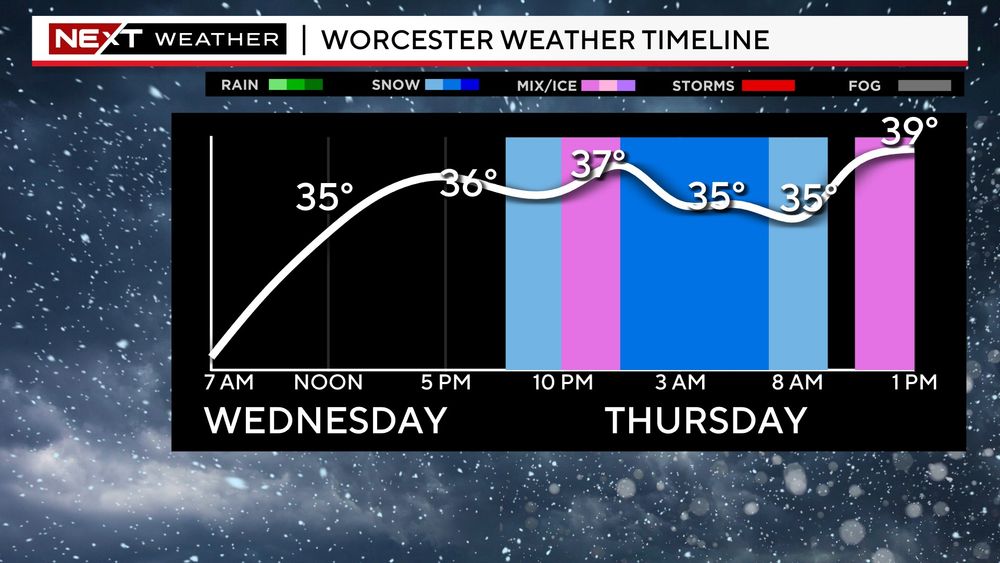
Storm timeline for Boston, NW suburbs and Worcester area...you can see different precip types depending on location but timeframe about the same
December 4, 2024 at 3:50 PM
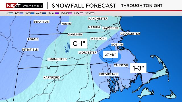
Snowfall forecast tonight remains about the same from yesterday...plowable in parts of Worcester county, shovels closer to 495
December 4, 2024 at 3:50 PM