


Matt Forrest
@forrest.nyc
All things modern GIS. https://forrest.nyc/
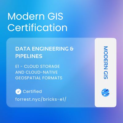
Check out the first micro-course here: forrest.nyc/bricks-e1/
Or take a look at the whole program: forrest.nyc/geospatial-d...
Or take a look at the whole program: forrest.nyc/geospatial-d...
E1: Cloud-Native Geospatial Files – Learn Cloud-Native Geospatial - Matt Forrest
MODERN GIS CERTIFICATION E1: Cloud-Native Geospatial Files This brick introduces the essential file formats powering modern, scalable spatial data workflows. You’ll get hands-on experience with format...
forrest.nyc
June 27, 2025 at 3:50 AM
Check out the first micro-course here: forrest.nyc/bricks-e1/
Or take a look at the whole program: forrest.nyc/geospatial-d...
Or take a look at the whole program: forrest.nyc/geospatial-d...
If you’ve ever wanted to learn this stuff, but don’t know where to start or want to have something to show for your skills.
Start small. Learn fast. Build modern spatial skills.
Brick E1 is live now.
Link + early bird discount in the next post 👇
Start small. Learn fast. Build modern spatial skills.
Brick E1 is live now.
Link + early bird discount in the next post 👇
June 27, 2025 at 3:50 AM
If you’ve ever wanted to learn this stuff, but don’t know where to start or want to have something to show for your skills.
Start small. Learn fast. Build modern spatial skills.
Brick E1 is live now.
Link + early bird discount in the next post 👇
Start small. Learn fast. Build modern spatial skills.
Brick E1 is live now.
Link + early bird discount in the next post 👇
E1 is part of a full “Data Engineering for Spatial” track: file formats to Apache Iceberg, to Airflow workflows, to CI/CD for spatial pipelines.
Each brick is practical. Stackable. And career-relevant.
Each brick is practical. Stackable. And career-relevant.
June 27, 2025 at 3:50 AM
E1 is part of a full “Data Engineering for Spatial” track: file formats to Apache Iceberg, to Airflow workflows, to CI/CD for spatial pipelines.
Each brick is practical. Stackable. And career-relevant.
Each brick is practical. Stackable. And career-relevant.
The Brick runs in a Gitpod notebook (zero setup) or locally if you want.
Watch the videos, run the code, push to GitHub, and the grader gives you a grade.
If it all checks out? You earn a badge.
A real, verifiable badge you can share anywhere.
Watch the videos, run the code, push to GitHub, and the grader gives you a grade.
If it all checks out? You earn a badge.
A real, verifiable badge you can share anywhere.
June 27, 2025 at 3:50 AM
The Brick runs in a Gitpod notebook (zero setup) or locally if you want.
Watch the videos, run the code, push to GitHub, and the grader gives you a grade.
If it all checks out? You earn a badge.
A real, verifiable badge you can share anywhere.
Watch the videos, run the code, push to GitHub, and the grader gives you a grade.
If it all checks out? You earn a badge.
A real, verifiable badge you can share anywhere.
You’ll learn how to:
Read & write Cloud-Optimized GeoTIFFs
Work with GeoParquet for scalable vector storage
Use AWS S3 to put this data in the cloud
Understand why these formats matter, even locally
Read & write Cloud-Optimized GeoTIFFs
Work with GeoParquet for scalable vector storage
Use AWS S3 to put this data in the cloud
Understand why these formats matter, even locally
June 27, 2025 at 3:50 AM
You’ll learn how to:
Read & write Cloud-Optimized GeoTIFFs
Work with GeoParquet for scalable vector storage
Use AWS S3 to put this data in the cloud
Understand why these formats matter, even locally
Read & write Cloud-Optimized GeoTIFFs
Work with GeoParquet for scalable vector storage
Use AWS S3 to put this data in the cloud
Understand why these formats matter, even locally
I've been down this road so I am trying to build something new:
✅ 4–6 hour mini-courses
✅ Auto-graded via GitHub
✅ Skills-first, backed by OpenBadges
✅ Stacked into career-focused tracks
The first stack of four focuses on Geospatial Data Engineering. Here is what is in the first "brick" or course:
✅ 4–6 hour mini-courses
✅ Auto-graded via GitHub
✅ Skills-first, backed by OpenBadges
✅ Stacked into career-focused tracks
The first stack of four focuses on Geospatial Data Engineering. Here is what is in the first "brick" or course:
June 27, 2025 at 3:50 AM
I've been down this road so I am trying to build something new:
✅ 4–6 hour mini-courses
✅ Auto-graded via GitHub
✅ Skills-first, backed by OpenBadges
✅ Stacked into career-focused tracks
The first stack of four focuses on Geospatial Data Engineering. Here is what is in the first "brick" or course:
✅ 4–6 hour mini-courses
✅ Auto-graded via GitHub
✅ Skills-first, backed by OpenBadges
✅ Stacked into career-focused tracks
The first stack of four focuses on Geospatial Data Engineering. Here is what is in the first "brick" or course:
The truth is, you don’t need a master’s degree to learn modern GIS.
You need small, focused learning units. You need real-world projects. You need proof of skills you can show.
And you need a path to do so, not just scattered tutorials.
You need small, focused learning units. You need real-world projects. You need proof of skills you can show.
And you need a path to do so, not just scattered tutorials.
June 27, 2025 at 3:50 AM
The truth is, you don’t need a master’s degree to learn modern GIS.
You need small, focused learning units. You need real-world projects. You need proof of skills you can show.
And you need a path to do so, not just scattered tutorials.
You need small, focused learning units. You need real-world projects. You need proof of skills you can show.
And you need a path to do so, not just scattered tutorials.
The gap is widening too. Cloud-native geospatial is moving fast and it is an in demand skill
Most GIS programs don't cover them. Most online courses barely scratch the surface. Most professionals are left to figure it out on their own.
Most GIS programs don't cover them. Most online courses barely scratch the surface. Most professionals are left to figure it out on their own.
June 27, 2025 at 3:50 AM
The gap is widening too. Cloud-native geospatial is moving fast and it is an in demand skill
Most GIS programs don't cover them. Most online courses barely scratch the surface. Most professionals are left to figure it out on their own.
Most GIS programs don't cover them. Most online courses barely scratch the surface. Most professionals are left to figure it out on their own.
IMO this leads to a mismatch in hiring where job postings ask for everything and the kitchen sink, the full stack geospatial expert, when that isn't the reality.
June 27, 2025 at 3:50 AM
IMO this leads to a mismatch in hiring where job postings ask for everything and the kitchen sink, the full stack geospatial expert, when that isn't the reality.
The options aren't great if you want to quickly learn a new technology and prove that you know it.
Traditional education usually is behind, and that leaves you sifting through blog posts and online tutorials.
Traditional education usually is behind, and that leaves you sifting through blog posts and online tutorials.
June 27, 2025 at 3:50 AM
The options aren't great if you want to quickly learn a new technology and prove that you know it.
Traditional education usually is behind, and that leaves you sifting through blog posts and online tutorials.
Traditional education usually is behind, and that leaves you sifting through blog posts and online tutorials.
Okay that helps. A lot of what I see online and LinkedIn looks like really cool 3D viewers but my assumption was that they can account for and work with different scenarios and show what it would look like. Or at least that is the goal which it sounds like what you are saying - thanks!
January 29, 2025 at 7:12 PM
Okay that helps. A lot of what I see online and LinkedIn looks like really cool 3D viewers but my assumption was that they can account for and work with different scenarios and show what it would look like. Or at least that is the goal which it sounds like what you are saying - thanks!
That’s my understanding too. But does it add anything beyond just beyond the visual aspect?
January 29, 2025 at 4:52 PM
That’s my understanding too. But does it add anything beyond just beyond the visual aspect?
3️⃣ Earth Observation Services - The boom in high-resolution satellite and drone data is transforming many different industries. EO platforms are democratizing access to actionable insights, enabling businesses to monitor, predict, and act with precision.
December 13, 2024 at 5:34 PM
3️⃣ Earth Observation Services - The boom in high-resolution satellite and drone data is transforming many different industries. EO platforms are democratizing access to actionable insights, enabling businesses to monitor, predict, and act with precision.
2️⃣ Agriculture - Precision agriculture is revolutionizing how we grow food. With drones, sensors, and increasingly better satellite imagery, farmers can optimize yields, reduce waste, and adapt to climate challenges.
December 13, 2024 at 5:34 PM
2️⃣ Agriculture - Precision agriculture is revolutionizing how we grow food. With drones, sensors, and increasingly better satellite imagery, farmers can optimize yields, reduce waste, and adapt to climate challenges.
1️⃣ Climate Risk - As climate change intensifies, geospatial tools are becoming essential for assessing and mitigating risks like floods, wildfires, and rising sea levels. Industries like insurance, ESG reporting, and real estate are leveraging predictive models and real-time analytics.
December 13, 2024 at 5:34 PM
1️⃣ Climate Risk - As climate change intensifies, geospatial tools are becoming essential for assessing and mitigating risks like floods, wildfires, and rising sea levels. Industries like insurance, ESG reporting, and real estate are leveraging predictive models and real-time analytics.
They don't today but I could do it I think...
December 9, 2024 at 8:44 PM
They don't today but I could do it I think...