EverydayHiker
@everydayhiker.bsky.social
240 followers 680 following 280 posts
Former fisheries scientist, current everyday hiker. Join me on the trail with daily photos of the hikes I’ve done. HQ photos at flickr.com/everydayhiker/
Posts Media Videos Starter Packs
everydayhiker.bsky.social
While along the shore of Hungry Mother Lake, there were about 7-10 Mallards swimming in the water. One male kept dunking on the other trying to show off to the mostly females nearby.

#Birding #Photography
A Mallard Duck flexing its wings near another male while the female pretends not to notice. A duck antagonizes another male by splashing it while taking off.  Landed literally 5 feet further. A  mallard duck just before breaching the water.  Another sits in the splash zone. A view of a female Mallard just before touching into the lake seen through the keyhole of fall colors.
everydayhiker.bsky.social
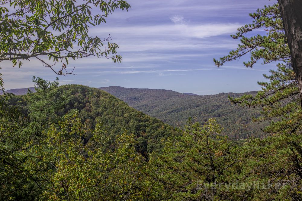
Located in SW Virginia, this fun loop takes you to a great viewpoint overlooking Hungry Mother SP before heading back down to a stroll along the lake. As you route down various ebbs of the hillside it always keeps a new view in perspective. Fall colors were a treat, just a little before peak there.
everydayhiker.bsky.social
Molly's Knob Loop Trail
Hungry Mother State Park, VA

Moderate, 5.81 mi loop
1,253 ft elevation gain
Hiked 10/12/25

Flickr Album flic.kr/s/aHBqjCxovS

#HungryMotherSP #Virginia #MollysKnob #hiking #photography #Autumn #FallFoliage
Walking up to the viewpoint at Molly's Knob with two benches to take in the view.  An expansive view is just beyond, the fall colors frame the benches well. The view out from Molly's Knob, I'm not sure what that ridge line is, possibly Clyburn ridge. The trail snakes through the fall colors as the hillsides ebb and flow. Fall colors along the lake shore.
everydayhiker.bsky.social
Located in Bland, VA, this section of the Appalachian Trail is well, kinda bland. Traveling just below the ridgeline for the majority of the hike, there are few viewpoints to be had. Good trail conditions and an even slope make it a good one for exercise, but for views I would look elsewhere.
everydayhiker.bsky.social
Appalachian Trail: Kimberline Creek to Laurel Creek
Bland, VA

Moderate, 9.9 mi out and back
1,781 ft elevation gain
Hiked 10/11/25

#AppalachianTrail #hiking #Virginia #photography
The rolling mountains beginning to yellow under streaky clouds. Looking out towards a farm from this early (and best) viewpoint along the trail.  Also had a leveled spot for camping here. The trail runs alongside the ridge throughout, never really cresting it.  Sloped hillsides are the main view along the trail. A mix of fall colors seen along the trail.
everydayhiker.bsky.social
‘He is from New York, I am from New York, we share the same donors.’

Same energy as RFk jr saying ‘I knew Harvey Weinstein. I knew Roger Ailes. I knew—OJ Simpson came to my house. Bill Cosby came to my house.’
everydayhiker.bsky.social
Everything was dry yesterday, I think tomorrow is bringing some rain so the leaves will probably be slick after that.
everydayhiker.bsky.social
This trail meanders its way up to the viewpoint at High Rocks, with its elevation spread throughout so that it maintains a leisurely pace. Mostly tucked into the trees, its only real views come at the top. Great for if you'd like to just put some miles under the feet. Overcast for majority of hike.
everydayhiker.bsky.social
High Rocks via Left Boundary Trail
Wytheville, VA

Moderate, 9.3 mi out and back
1,398 mi elevation gain
Hiked 10/10/25

#Virginia #hiking #photography
The view to the southwest from High Rocks viewpoint.  I believe that is Stuart Mountain in the center and Little Dry Run Wilderness behind it.  Some fall color showing, but the overcast clouds took a lot of the color away. A couple types of mushroom seen sharing the base of this tree. The view from High Rocks towards what I believe is the town of Stone Mill, VA. What I believe to be Stuart Mountain, as seen from High Rocks viewpoint.  Fall colors were muted by the gray sky.
everydayhiker.bsky.social
Heavily used as an overnighter with ample space for campsites along the flat ridgeline up top, this short trail does the majority of its ascent in the first 1.3 miles. Once up to there are a variety of views don into Linville Gorge as well as back towards Lake James. Parking lot fills up fast here.
everydayhiker.bsky.social
Shortoff Mountain
Linville Gorge Wilderness, NC

Moderate, 4.77 Out and Back
1,234 ft elevation gain
Hiked 10/5/25

Flickr Album flic.kr/s/aHBqjCwZdn

#LinvilleGorge #WNC #NorthCarolina #ShortoffMountain #hiking #photography
Looking towards Hawksbill Mountain, with a rocky outcrop nearby.  Linville river may be seen cutting its way through Linville Gorge. Looking down into the lowlands, a blanket of fog slowly pulls away.  The Linville River may be seen along the right of frame. A tree growing up from below has absorbed part of the rocky outcrop into its trunk.  Looked pretty funky in person. Various peaks and ridges may be seen in the distance with a section of the large flat area on top of Shortoff Mountain.
everydayhiker.bsky.social
Heavily used as an overnighter with ample space for campsites along the flat ridgeline up top, this short trail does the majority of its ascent in the first 1.3 miles. Once up to there are a variety of views don into Linville Gorge as well as back towards Lake James. Parking lot fills up fast here.
everydayhiker.bsky.social
Shortoff Mountain
Linville Gorge Wilderness, NC

Moderate, 4.77 Out and Back
1,234 ft elevation gain
Hiked 10/5/25

#LinvilleGorge #WNC #NorthCarolina #hiking #photography
Looking towards Hawksbill Mountain, with a rocky outcrop nearby.  Linville river may be seen cutting its way through Linville Gorge. Looking down into the lowlands, a blanket of fog slowly pulls away.  The Linville River may be seen along the right of frame. A tree growing up from below has absorbed part of the rocky outcrop into its trunk.  Looked pretty funky in person. Various peaks and ridges may be seen in the distance with a section of the large flat area on top of Shortoff Mountain.
everydayhiker.bsky.social
A shared use path with bike trails, this trail splits its time with forest and along the lake shore of Lake James with clear views of the surrounding area. Forest appears to have taken a lot of damage from a previous years ice storm. Lots of mushrooms to see; appears to be a bald eagle nest nearby.
everydayhiker.bsky.social
Fonta Flora Trail Loop
Morganton, NC

Easy. 4.3 mi loop
410 ft elevation gain
Hiked 10/4/25

Flickr Album flic.kr/s/aHBqjCwJWt

#WNC #NorthCarolina #LakeJames #hiking #photography
Near sunset over Lake James, the silhouette of a bald eagle may be seen flying home with a new stick for its nest. A tuft of Cauliflower Mushroom I came across while hiking, looks a little dried out. Looking westerly at Lake James, with what I believe to be Bald Knob and Dobson Knob seen in the distance. What appears to be a bald eagle flying with a big stick for its nest.  Taken with a wide angle lens, so even though I saw it coming, I couldn't get a better zoom on it than this (cropped).
everydayhiker.bsky.social
A great trail for getting the heart rate up, it takes a steep but manageable track along switchbacks to get to its one main viewpoint at Chestnut Knob. Views from here are expansive and show the foothills trailing off into the Piedmont area of NC. Loop route could be done as overnight w camp up top.
everydayhiker.bsky.social
Chestnut Knob to Sawtooth Loop
South Mountain State Park, NC

Moderate, 6.7 mi Loop
1,362 ft elevation gain
Hiked 10/4/25

Flickr Album flic.kr/s/aHBqjCwD2n

#SouthMountain #WNC #NorthCarolina #hiking #photography #ChestnutKnob
Looking over Chestnut Knob towards the surrounding foothills. A tall rocky outcrop rises above the trees growing beneath it, seen from the viewpoint at Chestnut Knob. I believe this is Dogwood Stamp Mountain rising above the surrounding foothills, seen from Chestnut Knob. Expansive view from the main overlook at Chestnut Knob.
everydayhiker.bsky.social
As a side note, the lower reaches of this trail to the waterfall is most likely the very first hike a young 'back-in-the-day hiker' did while there for some brook trout fishing with my dad.
everydayhiker.bsky.social
A large dome of exposed granite, Stone Mountain provides sweeping views of the surrounding area and is also known for rock climbing in NC. Trail also takes you to a 200ft sliding waterfall which can be done as a shorter hike, or lengthened by adding the blackjack ridge section at the end of the hike
everydayhiker.bsky.social
Stone Mountain Loop and Blackjack Ridge Loop
Traphill, NC

Moderate, 7.5 mi Loop (two loops with same endpoint combined)
1,650 ft elevation gain
Hiked 9/28/25

Flickr album flic.kr/s/aHBqjCwvGw

#StoneMountain #NorthCarolina #hiking #photography #waterfalls #PrayingMantis #monadnock
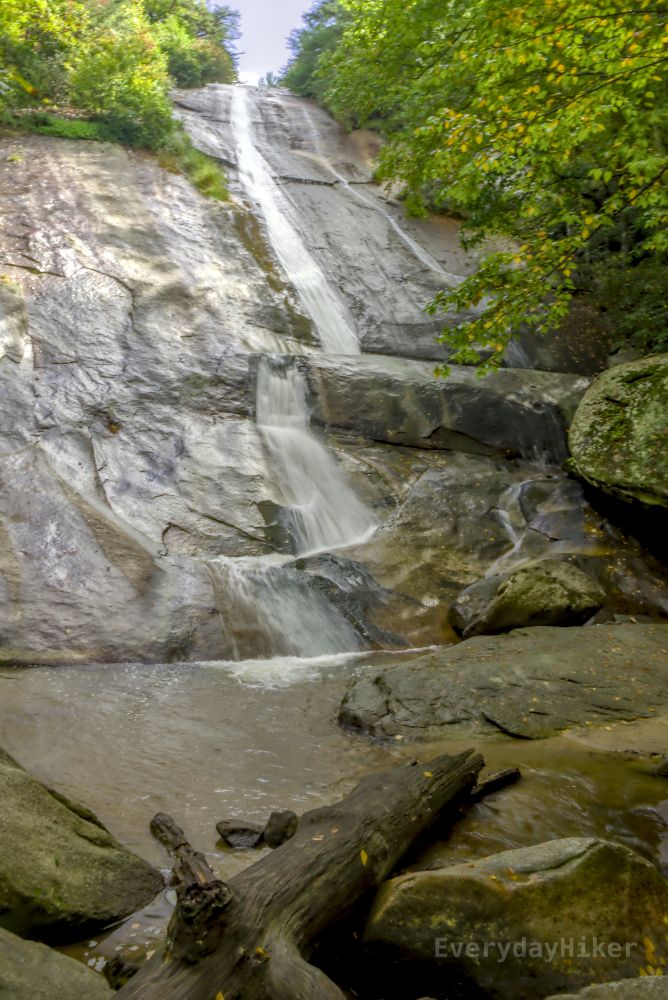
Looking across the mostly bald summit of Stone Mountain, a lone tree stands firm. The long, sliding, Stone Mountain Falls drops roughly 200 feet to a shallow pool below.  Shot at 1/8. A Praying Mantis looks over at the camera while sunning on Cedar Rock.
everydayhiker.bsky.social
Caterpillars in full force that day, with a Hickory Tussock moth and an Isabella Tiger Moth in the lower gorge and upper grasslands of the trail, respectively.

#caterpillars
A larval Hickory Tussock Moth I saw early on the trail in the gorge area. Isabella Tiger moth crawling across the grassy trail in the upper area.
everydayhiker.bsky.social
Also saw this incredibly photogenic Definite Tussock Moth caterpillar, who introduced themselves by crawling all over my neck. Rude! I can't stay mad at a face like that however, so all good.

#caterpillars #DefiniteTussockMoth
A Definite Tussock Moth just popping in to say hello. A Definite Tussock Moth crawls towards the camera. A Definite Tussock Moth giving me the blank stare after I so rudely tossed it off of my neck.
everydayhiker.bsky.social
This strenuous loop along the Appalachian Trail/Blue Ridge Parkway begins at the top near The Saddle Overlook before descending into a deep ravine below, providing you with both viewpoints up top and lush vegetation down low. The ascent/descent can be very steep and slippery, so be prepared...
everydayhiker.bsky.social
Rock Castle Gorge Loop
Floyd, Virginia

Hard, 10.83 mi loop
2,671 ft elevation gain
Hiked 9/26/25

Flickr flic.kr/s/aHBqjCwpCB

#AppalachianTrail #BlueRidgeParkway #RockCastleGorge #Virginia #hiking #photography
Looking eastward from near the top of the hike.  I believe the high point to the right is twelve o' clock knob, but am not certain. Wide open views of the surrounding ridge lines from some of the farmland along the top that has granted public access. Little Rock Castle creek pushes through a logjam before heading into this riffle.  Shot at 1/13 'Aight imma head out.'  (Groundhog)
everydayhiker.bsky.social
At roughly the same elevation gain and distance as McAfee Knob, it is far more difficult due to the elevation being in a few places instead of spread evenly. Though I found it more rewarding and with better views at the top than McAfee and with less (zero) crowds. Route is half Appalachian Trail.